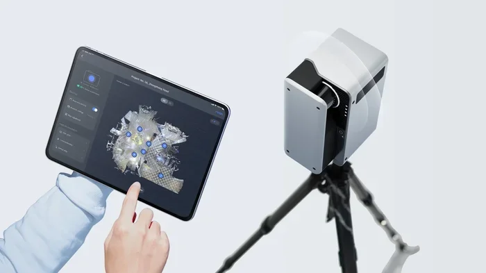
Realsee Galois 3d Lidar Camera
The Realsee Galois 3d lidar camera delivers highly accurate spatial data for professionals who need reliable 3D mapping. It combines fast laser scanning with intuitive software to simplify complex measurement tasks. You will learn how this device improves workflow, reduces errors, and fits into real world projects. This guide breaks down the core features, use cases, and setup tips in plain language.
If you have ever struggled with slow measurements or messy hand drawn plans, you know how valuable accurate spatial data can be. The Realsee Galois 3d lidar camera aims to solve that problem by capturing real world geometry with speed and confidence. It is built for people who need dependable scans without spending hours on setup. In this guide, I will walk you through what makes this device useful, where it fits best, and how to get the most out of it.
You do not need to be a scanning expert to appreciate a tool that makes 3D data easier to collect. Whether you are documenting a room, checking a site layout, or building a digital twin, clear measurements matter. A good 3d lidar camera can save time, reduce guesswork, and give you a cleaner starting point for later work. That is the big promise here, and it is worth understanding before you buy or deploy one.
Below, I will explain the core ideas behind this technology, then break down the practical details you actually care about. I will also share tips on setup, data handling, and common mistakes to avoid. My goal is simple: help you decide if this scanner matches your workflow and how to use it well.
Key Takeaways
- High precision scanning: The Realsee Galois 3d lidar camera captures detailed spatial measurements with minimal noise.
- Fast data collection: Rapid laser pulses help you complete scans quicker than manual methods.
- Easy integration: Compatible software tools let you import point clouds into common design workflows.
- Versatile applications: Ideal for indoor mapping, site documentation, and spatial analysis.
- User friendly setup: Straightforward calibration and clear indicators reduce the learning curve.
- Reliable accuracy: Consistent results support planning, inspection, and documentation tasks.
- Future ready workflow: Regular updates and strong data formats help long term project use.
📑 Table of Contents
Why the Realsee Galois 3d Lidar Camera Stands Out
When people compare scanning tools, they usually want the same few things: accuracy, speed, and ease of use. The Realsee Galois 3d lidar camera is designed with those priorities in mind. It uses laser based ranging to measure distances and shape, which gives you a dense set of spatial points instead of rough estimates. That matters when small details affect your final result.
Another advantage is the balance between portability and performance. Some scanners feel powerful but clumsy. Others are easy to carry but miss important detail. This device tries to sit in the middle, where you can move through a space without dragging around heavy gear while still collecting useful 3D information. For many jobs, that balance is the real value.
It also helps that the data can be used for more than one purpose. You might scan for documentation today and reuse the same dataset for planning tomorrow. That flexibility makes the Realsee Galois 3d lidar camera appealing for teams that want one tool instead of several specialized ones.
Laser Scanning Basics in Simple Terms
Lidar works by sending out laser signals and measuring how long they take to return. The result is a collection of distance measurements that form a point cloud. Think of it as a digital spray of points that maps the shape of a space. The more consistent and dense those points are, the easier it is to work with the final model.
A 3d lidar camera does not capture a photo the same way a regular camera does. It captures geometry. That means it is especially useful when you care about distances, surfaces, and spatial relationships. If your job depends on knowing where things are in three dimensions, this approach is often stronger than manual measuring.
Who Benefits Most From This Type of Scanner
This kind of device is useful for anyone who needs repeatable spatial data. That includes site inspectors, space planners, survey support teams, and people who document existing conditions. It can also help if you want to compare a current space against a design or earlier scan.
If your work involves frequent measuring in tight or complex spaces, a Realsee Galois 3d lidar camera can reduce the back and forth that usually slows projects down. It is not magic, but it does make the measuring process more structured and less tiring.
Core Features and What They Mean for You
A scanner is only as useful as the features that support your daily workflow. With the Realsee Galois 3d lidar camera, the most important features are the ones that affect accuracy, speed, and data quality. I will keep this practical and focus on what those features actually change for you.
First, the scanning speed matters because it affects how much ground you can cover in one session. Faster collection can mean fewer setup interruptions and less time spent repositioning. That is especially helpful when you are working in active spaces or trying to capture a room before it changes.
Second, measurement consistency is key. A good lidar system should give you stable results when you scan the same area more than once. That consistency is what allows you to trust the data later, whether you are checking dimensions or comparing changes over time.
Point Cloud Quality and Detail
Point cloud quality is one of the biggest factors in how useful your scan will be. A stronger dataset gives you cleaner edges, better surface representation, and fewer gaps to fix later. When you look at a 3d lidar camera, you want to know how well it handles both open areas and tighter corners.
In practice, good point clouds make downstream work easier. You spend less time cleaning noise and more time using the data. That is a major reason why people choose lidar-based tools instead of slower manual methods.
Portability and On Site Use
Portability sounds simple, but it changes how a tool fits into real work. If a scanner is easy to carry, you are more likely to bring it to the right place and use it often. You also save energy during long sessions, which helps when you are moving through multiple rooms or levels.
The Realsee Galois 3d lidar camera is appealing here because it supports a more flexible workflow. You can adapt to different spaces without feeling burdened by the gear. That flexibility is often what turns a device from nice to have into useful day to day.
Best Use Cases for Spatial Scanning
One of the best ways to judge a scanner is to ask where it saves the most time. The Realsee Galois 3d lidar camera fits well in situations where you need a reliable record of space and shape. It is not just for high tech projects. It can support ordinary documentation work too.
Indoor spaces are a strong fit because they often require careful measurement of walls, openings, and fixed objects. If you need to capture a room as it exists today, lidar can give you a solid baseline. That baseline can support renovation planning, space checks, and as-built records.
Outdoor use can also be valuable when the area is structured and you need a clear spatial reference. A 3d lidar camera can help with site layout, perimeter documentation, and visual records of how elements relate to each other. The key is choosing environments where the scanner can collect clean returns without too much interference.
Indoor Mapping and Documentation
Indoor mapping is often where lidar shows its strengths most clearly. Rooms, corridors, and built in features create a predictable scanning environment. You can move through the space, collect data, and later review the shape in detail. That makes the Realsee Galois 3d lidar camera useful for record keeping and measurement support.
This is especially helpful when you want to avoid going back and forth with a tape measure or checking the same distance multiple times. A scan gives you a broader view of the space and lets you revisit the data without returning to the site right away.
Planning, Inspection, and As-Built Records
Planning work benefits from accurate existing condition data. If you know the real layout first, you can plan with less uncertainty. Inspection work also benefits because you can compare what you see in the field with what the scan shows later. That second look often reveals details you missed in the moment.
As-built records are another strong use case. When a space is finished or changed, a scan can serve as a reliable reference. The Realsee Galois 3d lidar camera helps create that reference faster than many manual methods, which is a real advantage on busy projects.
Setup, Calibration, and Best Practices
Good results start with good setup. Even a capable device can underperform if it is used carelessly. With the Realsee Galois 3d lidar camera, the setup process should be straightforward, but a few habits will make your scans much better.
Start by choosing a stable position. If the scanner moves during capture, the data can become less reliable. A solid stance and careful handling go a long way. It also helps to scan in a way that gives the laser a clear path to the surfaces you care about.
Calibration and check steps are important too. Before you rely on a scan for decisions, make sure the device is ready and the capture conditions make sense. A few extra minutes here can prevent a lot of cleanup later.
Tips for Cleaner Scans
- Clear the path: Reduce unnecessary obstacles when possible so the scanner can reach the surfaces you need.
- Watch reflective areas: Highly reflective surfaces can sometimes complicate readings, so take extra care around glass or shiny finishes.
- Overlap your scans: Slight overlap can improve coverage and help you catch missing areas.
- Check lighting and conditions: Some environments are easier to scan than others, so note any conditions that may affect quality.
- Review data on site: A quick check before leaving can save a second visit later.
Common Mistakes to Avoid
- Rushing the capture: Moving too fast can leave gaps or reduce consistency.
- Ignoring obstructions: Hidden corners and blocked views can create weak spots in the data.
- Skipping a quick verification: Always confirm that the scan matches the space you intended to capture.
- Assuming one scan is always enough: Complex spaces may need more than one pass.
- Forgetting to label sessions: Clear notes make it easier to sort scans later.
Working With the Data After Capture
Collecting the scan is only half the job. The other half is turning that data into something useful. With a Realsee Galois 3d lidar camera, the goal is to move from raw spatial points to a clean result you can actually use. That usually means checking the dataset, trimming unnecessary parts, and exporting it in a format that fits your workflow.
A good workflow keeps the data organized. Name your files clearly. Keep track of where each scan was taken. Note the date and purpose if you plan to compare multiple sessions. These small habits make the data much easier to manage as projects grow.
It also helps to think ahead about how the data will be used. If you need measurements, focus on accuracy and coverage. If you need a visual record, focus on completeness and clarity. A 3d lidar camera can support both, but your process should match the goal.
Export, Storage, and Sharing
Data handling matters because scans can become large and easy to misplace if you are not careful. Store copies in more than one location when the project is important. Use clear folder structures so you can find the right scan later. If you share the data with a team, make sure everyone knows which version is current.
When you export data, choose a format that fits the next step. Some tools need lighter files. Others need richer spatial detail. The Realsee Galois 3d lidar camera should be paired with a workflow that respects both the data size and the project purpose.
Integrating Scans Into Your Workflow
The best scanning tools are the ones that fit smoothly into existing work. If the scan can be imported, viewed, and checked without a long learning curve, people will actually use it. That is why compatibility matters just as much as raw performance.
Think of the scan as a shared reference. It can support design review, site checks, and team communication. When the data is easy to interpret, the Realsee Galois 3d lidar camera becomes more than a capture tool. It becomes part of how your team understands space.
Comparing It to Other Scanning Options
It helps to compare this device to other ways of capturing space. Manual measuring is simple and cheap, but it is slow and prone to small errors. Photograph-based methods can be visually rich, but they do not always give you the same level of spatial precision. A 3d lidar camera sits in a different category because it focuses on measured shape rather than just appearance.
The right choice depends on the job. If you need quick visual reference, photos may be enough. If you need reliable distances and spatial structure, lidar is often the stronger option. The Realsee Galois 3d lidar camera is most compelling when you want a cleaner, more measurable record of a space.
When Manual Methods Still Make Sense
Manual methods still matter. For a single quick measurement, a tape measure may be faster than setting up a scanner. For very small jobs, simple tools can be more practical. The key is knowing when the extra detail of lidar is worth the effort.
If the project involves many measurements, repeated checks, or complex layout work, the scanner usually earns its place. If the job is tiny and straightforward, a lighter approach may be enough. A Realsee Galois 3d lidar camera shines when scope and accuracy both matter.
Final Thoughts Before You Buy
Before choosing any scanner, think about your real use cases. Ask yourself how often you will scan, how accurate the results need to be, and how much time you want to spend processing data. The Realsee Galois 3d lidar camera is a strong option when you want reliable spatial capture without making the process overly complicated.
If you need a tool that helps you document spaces, support planning, and reduce repetitive measuring, this type of device can be a smart fit. The best results come from matching the tool to the job and using it with a clear process. That is how you turn a scan into something genuinely useful.
In the end, the Realsee Galois 3d lidar camera is about making spatial data more accessible and more dependable. When used well, it can save time, improve confidence, and give you a better starting point for the rest of your work. If your projects depend on knowing the shape of the world around you, that is a meaningful advantage.
Frequently Asked Questions
What is the Realsee Galois 3d lidar camera used for?
It is used to capture spatial data and 3D shape information for spaces and objects. People use it for documentation, mapping, and measurement support when they need more detail than manual tools can easily provide.
How accurate is a 3d lidar camera in real world use?
Accuracy depends on the device, the environment, and how carefully you scan. In general, lidar-based tools can provide reliable distance data, but you still need good setup and clear capture conditions for the best results.
Do I need special software to work with the scan data?
Usually yes, because raw scan data is easiest to use when it is viewed, cleaned, or exported through compatible software. The exact tools depend on your workflow and the file formats you plan to use.
Can the Realsee Galois 3d lidar camera be used indoors and outdoors?
It can be used in both settings, but each environment has different challenges. Indoors often gives cleaner results because the space is more controlled, while outdoors may require more attention to conditions and obstructions.
What should I check before buying a lidar camera?
Check accuracy needs, portability, software compatibility, battery life, and how easy the device is to use in the field. It also helps to think about how much data processing you want to handle after each scan.
Is lidar better than photos for documenting a space?
It depends on the goal. Photos are great for visual context, while lidar is stronger for measuring shape and distance. Many projects benefit from using both, but lidar is especially useful when spatial precision matters.